Map of Lake St. Clair No Wake Zones “2024 Season”
Posted December 18, 2023 9:05 am
in
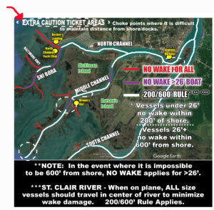
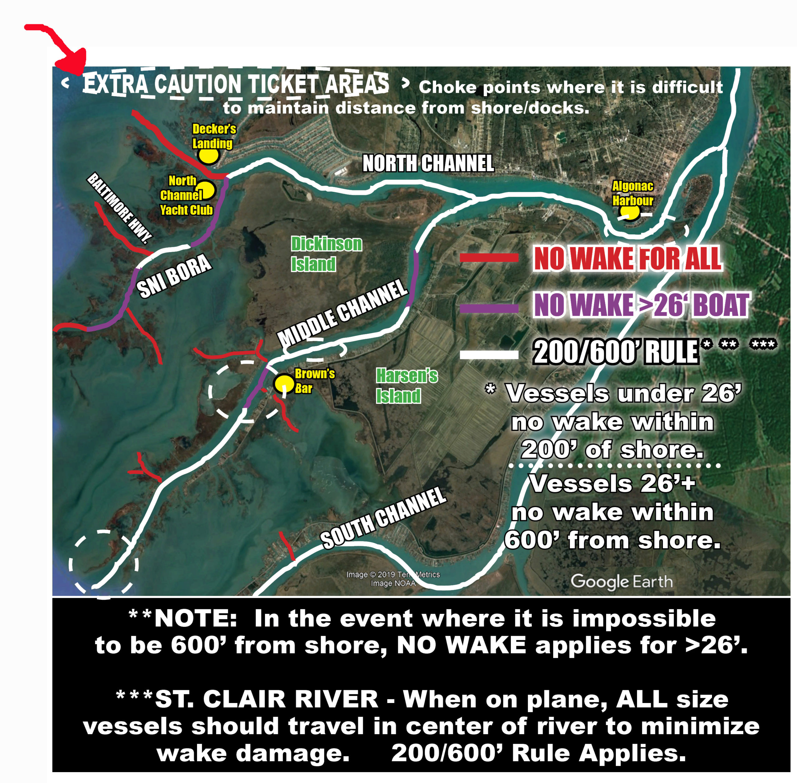
2024 NO WAKE ZONE map Lake St. Clair, St. Clair River, North, South, & Middle Channels, Sni Bora-Chenal Bout Rond, Detroit River, and St. Clair Shores area of the "Nautical Mile".
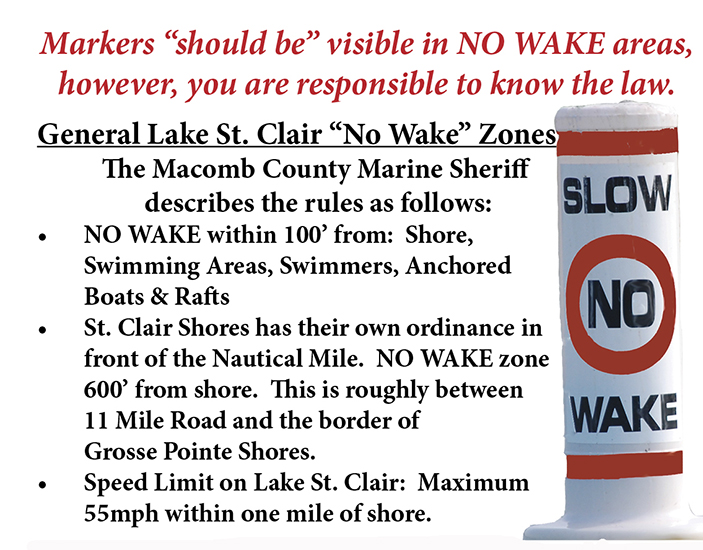
The updated no wake zone map has been reviewed & approved by the Macomb and St. Clair County Marine Sheriff. Important to please also note shore includes "docks & piers" sticking out into the channels.
IMPORTANT - PLEASE NOTE EXTRA CAUTION No Wake AREAS CIRCLED BELOW WHERE WATERWAYS ARE NARROW and difficult for any size vessel or waverunner to be 200' from shore.
Click map below to read full Lake St. Clair Guide Magazine!
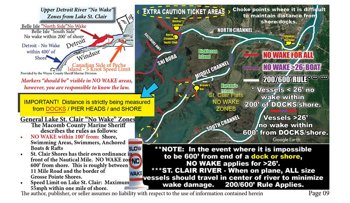
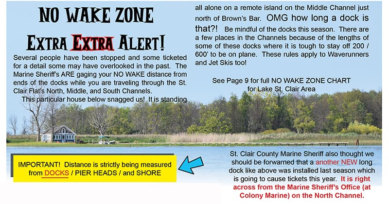
Don't get a needless ticket, and check out the map of Lake St. Clair No Wake Zones. Even if you do not see a marker, you are responsible to know the law.
Don't forget to check our mobile friendly web directory for boat rentals & repair services, marinas, waterfront restaurants & communities, fishing services, and more to fully enjoy Lake St. Clair this season!
The Lake St. Clair Guide magazine provides maps to several things boaters need.... including the very important 2024 NO WAKE ZONE map.