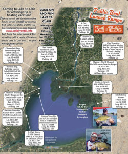
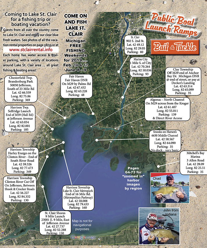
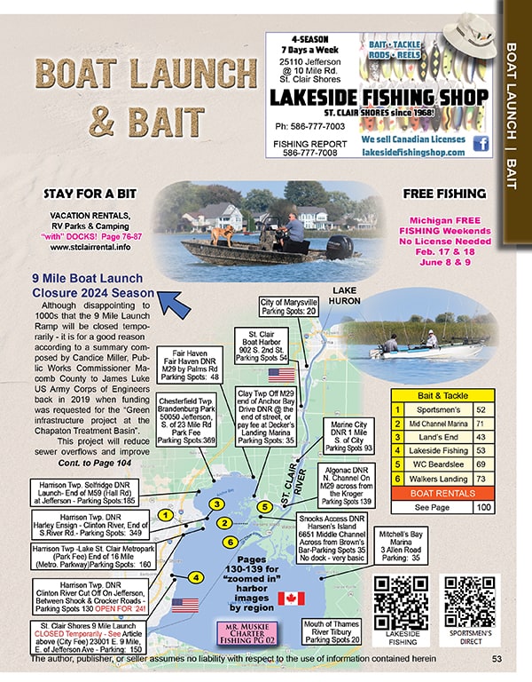
Map of Lake St. Clair & St. Clair River Boat Launch Ramps
Need a Map of Lake St. Clair DNR and Public Boat Launch Ramps? Michigan Fishing License?
The Lake St. Clair Guide magazine and website provides several maps to help you make the most of your time on Lake St. Clair.

Click here for LIVE Webcam
The most popular launch ramps on Lake St. Clair include the northern Fair Haven DNR Ramp, centrally located Selfridge DNR Ramp, Harley Ensign DNR Ramp at the end of the Clinton River, the Clinton River Cut Off Ramp, and the Algonac DNR Ramp on the North Channel (see map below).
Update March 20, 2024
All the popular Macomb & St. Clair County ramps will be open for the 2024 boating season with the exclusion of the 9 Mile Launch Ramp for 2024/2025 in the City of St. Clair Shores for area infrastructure improvements.
Please see map below for alternative locations during the 9 Mile Launch Ramp closure.
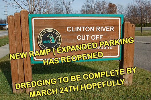
Clinton River Cut Off Updated March 20, 2024:
Update! Dredging began March 18, 2024 and should be complete this week at the Clinton River Cut Off Boating Access Site. Dredging was required due to very shallow conditions where new ramp is now located.
The Clinton River Cut Off Boating Access Site reopened March 8 with a new launch ramp and expanded parking. However, please note dredging & intermittent closures during late March.
Click map to read full Lake St. Clair Guide Magazine!
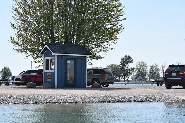
The good news with water levels down, the Middle Channel/Muscamoot Snooks Access on Harsen’s Island across from Brown’s Bar and the Decker’s DNR Access on the North Channel in Clay Township are both high and dry.
PHOTO: Snooks Access on Harsen’s Island (Across from Brown's Bar) - No docks
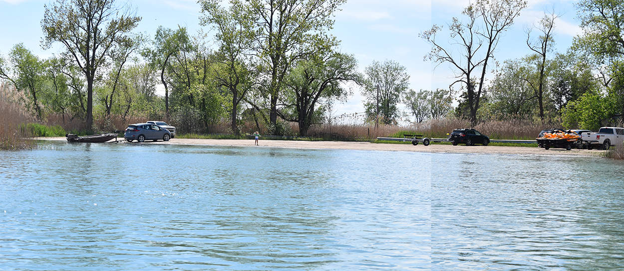
PHOTO: Decker’s DNR Access on the North Channel in Clay Township
We have several areas for fishing..... do you want to focus on Walleye? Muskie? Smallmouth? Perch? Find the closest public launch site to where your fish are biting.
Do you need a Michigan Recreational Passport License to launch your Boat??
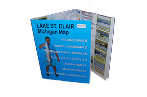
Need some advice on where to go? The Lake St. Clair Guide magazine also offers a 17" x 20" map which outlines fishing areas, trolling areas, bait stores, services, as well as 80+ "on shore landmark photos" to help find your way around this 26 mile long x 26 mile wide lake. Click here for Boating Map details....
Don't forget to check our mobile friendly web directory for boat rentals & repair services, marinas, waterfront restaurants & communities, fishing services, and more to fully enjoy Lake St. Clair this season!
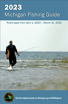
What are the Fishing Regulations for Michigan? Buy a Michigan fishing license, identification of species, official Michigan Fishing Guide for convenience, and more fishing links ...